- Turnagain Island
-
Turnagain Island
(Buru)Lage der Torres-Strait-Inseln:
Turnagain oben, Mitte.Gewässer Pazifischer Ozean Inselgruppe Torres-Strait-Inseln Geographische Lage 9° 33′ 54″ S, 142° 17′ 23″ O-9.565142.28972222222Koordinaten: 9° 33′ 54″ S, 142° 17′ 23″ O 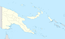

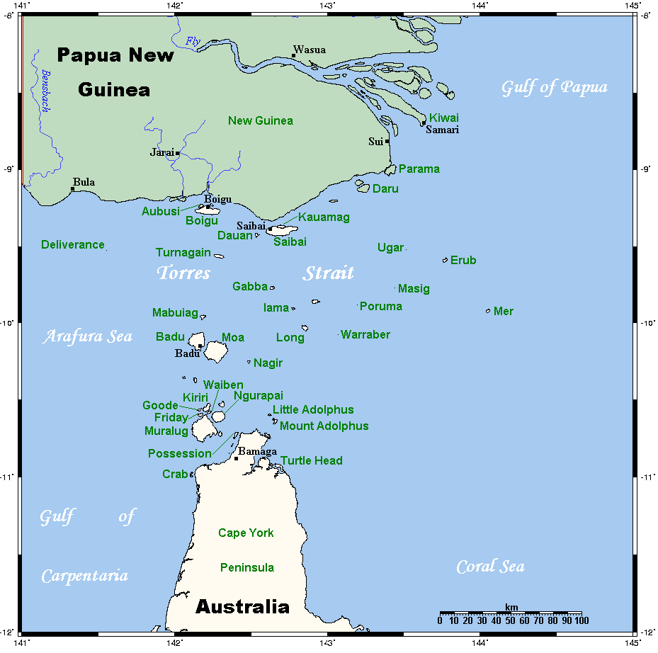
Länge 7,5 km Breite 2,2 km Fläche 11,97 km² Einwohner (unbewohnt) Turnagain Island, auch Buru genannt, ist eine kleine unbewohnte Insel der Torres-Strait-Inseln. Sie liegt etwa 38 km südlich der Küste von Papua-Neuguinea und über 125 km nördlich der Kap-York-Halbinsel, gehört aber dennoch zum australischen Bundesstaat Queensland. Die nächstgelegenen Inseln sind Dauan (29 km nordöstlich) und Boigu (29 km nordwestlich), beide bewohnt.
Verwaltungstechnisch zählt Turnagain Island zu den Top Western Islands, einer Inselregion im Verwaltungsbezirk Torres Shire.
Die vollständig bewaldete, längliche Insel ist von einem Korallenriff umgeben.
Siehe auch
Inselregionen, Hauptinseln und Inselgruppen im Archipel der Torres-Strait-Inselnzu Papua-Neuguinea gehörige Torres-Strait-Inseln: Bristow Island | Daru Island | Parama Island • Kawai-Inseln | Talbot-Inseln
Top Western: Boigu | Dauan | Deliverance | Saibai | Turnagain • Talbot-Inseln
Western: Badu | Mabuiag | Moa | Portlock | Tobin • Bellevue-Inseln | Duncan-Inseln | Farewell-Inseln | Kulbi-Inseln
Central: Aureed | Bourke | Coconut | Sassie | Sue | Yam | Yorke • Bourke-Inseln | The Three Sisters | Yorke-Inseln
Eastern: Bramble | Darnley | Murray | Stephens • Murray-Inseln
Inner: Albany | Booby | Crab | Entrance | Friday | Goods | Hammond | Horn | Packe | Port Lihou | Prince-of-Wales | Thursday | Wednesday • Manar-Inseln | Red-Wallis-Inseln | Thursday-Inseln | Tuesday-Inseln
Wikimedia Foundation.
Schlagen Sie auch in anderen Wörterbüchern nach:
Turnagain Island (Queensland) — Turnagain Island (Buru Island) is situated in the Northern section of Torres Strait, about 80km South of Papua New Guinea. This island is one of the Torres Strait Islands External linksTorres Strait Treaty* [http://www.dfat.gov.au/geo/torres… … Wikipedia
Fire Island (Anchorage, Alaska) — Fire Island is a convert|5.5|mi|km|sing=on long island in the U.S. state of Alaska, located near the head of Cook Inlet at coor dms|61|09|34|N|150|11|55|W|region:US. It is the only island in the Municipality of Anchorage, sitting three miles (5… … Wikipedia
Thursday Island — Landsat Bild von Thursday Island (unten) und Hammond Island (oben) … Deutsch Wikipedia
Friday Island (Torres Strait) — Friday Island Landsat Bild von Friday Island Gewässer Pazifischer Ozea … Deutsch Wikipedia
Parama Island — (Bampton Island) Landsat Bild von Parama Island (Anm.: unter den Wolken!) Gewäss … Deutsch Wikipedia
Sassie Island — (Long Island) Landsat Bild von Sassie Island Gewässer Pazifischer Oze … Deutsch Wikipedia
Stephens Island (Torres Strait) — Stephens Island (Ugar) Landsat Bild der Insel mit dem wesentlich größeren umgebenden Korallenriff … Deutsch Wikipedia
Badu Island — w1 Badu Island Landsat Bild von Badu Island Gewässer Torres Straße … Deutsch Wikipedia
Goods Island — (Palilug) Landsat Bild von Goods Island Gewässer … Deutsch Wikipedia
Hammond Island — w1 Hammond Island Landsat Bild von Hammond Island (oben, Norden) und Thursday … Deutsch Wikipedia
Turnagain Island

18+
© Academic, 2000-2024
- Kontaktieren Sie uns: Unterstützung, Werbung
Wörterbücher Export, schritte mit PHP, Joomla, Drupal, WordPress, MODx.