Gravelbourg (Saskatchewan)
- Gravelbourg (Saskatchewan)
-
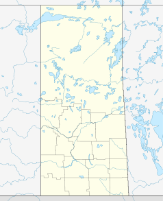
Gravelbourg ist eine 1906 gegründete Kleinstadt im Süden von Saskatchewan, Kanada, in der traditionell französisch gesprochen wird. Sie liegt in einem Verkehrskorridor jeweils ca. 100 km von Moose Jaw, Swift Current und der Grenze zu den Vereinigten Staaten. Diese Region war schon für die Ureinwohner ein wichtiges Durchgangsgebiet und wurde im 19. Jahrhundert auch vom Redcoat Trail berührt. Gravelbourg ist jetzt eine wichtige Station des Trans Canada Trail.
Die Stadt war während vielen Jahren römisch-katholischer Bischofssitz. 1998 löste Papst Johannes Paul II. die Diözese Gravelbourg auf und die Pfarrkirche Our Lady of the Assumption wurde formal Konkathedrale des Erzbistums Regina. Seither ist die Stadt Namensgeberin eines Titularbistums.
Seit über vierzig Jahren ist Gravelbourg bekannt für das Collège Mathieu, ein französischsprachiges Internat für Jungen, und den inzwischen aufgelösten Couvent Jésus Marie für Mädchen.
Weblinks
Wikimedia Foundation.
Schlagen Sie auch in anderen Wörterbüchern nach:
Gravelbourg, Saskatchewan — Infobox Settlement official name = Town of Gravelbourg other name = native name = nickname = settlement type = motto = imagesize = image caption = flag size = image seal size = image shield = shield size = city logo = citylogo size = pushpin… … Wikipedia
Gravelbourg — steht für Gravelbourg (Saskatchewan), Ort in Saskatchewan Gravelbourg (Titularbistum), ehemaliges Römisch Katholisches Bistum Diese Seite ist eine Begriffsklärung zur Unterscheidung mehrerer mit demselben Wort bezeichnet … Deutsch Wikipedia
Gravelbourg Airport — is located convert|1|NM|abbr=on|lk=in southwest of Gravelbourg, Saskatchewan, Canada.References … Wikipedia
Gravelbourg — Administration Pays Canada Province … Wikipédia en Français
Saskatchewan Group — Stratigraphic range: Frasnian … Wikipedia
Saskatchewan Highway 58 — Infobox road province=SK type=Hwy route=58 maint= length km=129 length round=0 length ref= established= direction a=South starting terminus=Hwy 18 junction=Hwy 13 at Lafleche direction b=North ending terminus=Hwy 1/Hwy 19 near Chaplin rural… … Wikipedia
Gravelbourg No. 104, Saskatchewan — Infobox Settlement official name = Gravelbourg No. 104 other name = native name = nickname = settlement type = motto = imagesize = image caption = flag size = image seal size = image shield = shield size = city logo = citylogo size = mapsize =… … Wikipedia
Saskatchewan Highway 43 — Infobox road province= marker highway name=Highway 43 name notes= type= route= alternate name= maint= section= length first=km length km=131 length mi=81 length round= length ref= length notes= established= decommissioned= direction a=West… … Wikipedia
Saskatchewan Highway 1 — Pioneer homesteaders in the early 1900s farmed quarter section homesteads which were ] Piapot Creek, Bear Creek and Skull Creek are near the Bench also known as the Cypress Hills plateau. After leaving the Maple Creek Plain, there is the Gull… … Wikipedia
List of articles about Saskatchewan CCF/NDP members — This is a list of Wikipedia articles about members of the Saskatchewan, Canada, branch of the Co operative Commonwealth Federation (CCF), a social democratic political party, and its successor, the Saskatchewan New Democratic Party (NDP).1929… … Wikipedia