- Selianitika
-
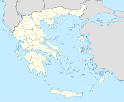
Selianitika
ΣελιανίτικαBasisdaten Staat: Griechenland Region: Westgriechenland Regionalbezirk: Achaia Gemeinde: Egialia Geographische Koordinaten: 38° 16′ N, 22° 1′ O38.26666666666722.016666666667Koordinaten: 38° 16′ N, 22° 1′ O Höhe ü. d. M.: 0 m Fläche: 2.8[1] Einwohner: 1147 (2001[1]) Bevölkerungsdichte: 409,6 Ew./km² LAU-1-Code-Nr.: 131815 Selianitika (griechisch Σελιανίτικα (n. pl.)) ist ein Dorf im Gemeindebezirk Symbolitia der Gemeinde Egialia in Griechenland. Es liegt an der Nordküste der Peloponnes am Golf von Korinth, etwa 7 km westlich von Egio und 30 km östlich von Patras. Selianitika hat 1.147 Einwohner (Stand 2001)[2].
Selianitika und sein Nachbarort Longos sind durch einen etwa 1,5 km langen Strand verbunden. Beide Orte sind während der Sommermonate beliebte Ausflugsziele.
Inhaltsverzeichnis
Geografische Lage und Klima
Das Dorf liegt am Golf von Korinth in schöner Umgebung mit Weingärten, Oliven- und Zitrusbäumen. Die nächste Stadt in östlicher Richtung ist das 7 km entfernte Egion. Patras, die drittgrößte Stadt Griechenlands und das Verwaltungszentrum von Achaea, ist etwa 30 bis 35 km entfernt.
Der Ortskern von Selianitika liegt etwa 30m über Seehöhe. Zum Ort gehört ein ausgedehnter Strand mit feinem Kies, wie er am Golf von Korinth häufig zu finden ist. Der Strand erstreckt sich bis zum Nachbarort Longos und ist bekannt für sein sauberes, blau scheinendes Wasser.
Am Strand hat man eine gute Aussicht auf die südliche liegenden Klokos-Berge, auf Panachaiko im Südwesten und über den Golf von Korinth hinüber auf das Fokida-Gebirge im Norden.
Das Klima der Region ist angenehm mediterran mit milden Wintern und gemäßigt heißen Sommern.
Verkehr
Abgesehen von der alten Nationalstraße (griechisch Palea Ethniki Odos Παλαιά Εθνική Οδός) GR-8, die den Ort mit Egion, Patras und den benachbarten Dörfern verbindet, besitzt Selianitika auch einen Anschluss an die sogenannte neue Nationalstraße (gr. Nea Ethniki Odos Νέα Εθνική Οδός) (GR-8A, Athen–Korinth–Patras).
Für die neue Autobahn Elefsina–Korinth–Patras–Tsakona[3] [4]als Ausbau der Nationalstraße GR-8A auf Autobahnstandard ist eine Ausfahrt für Selianitika/Longos vorgesehen, der Baubeginn wird für 2009 erwartet.
Infrastruktur
In Selianitika gibt es eine Grundschule, die nächste weiterführende Schule und ein Gymnasium befinden sich in Erineos und Egio. An dem Dorfplatz (Platia) liegt die zentrale Kirche Heiliger Basilus, ein Geldautomat der Griechischen Nationalbank, ein Supermarkt und kleinere Geschäfte, ein Zeitschriftenladen mit internationalen Zeitungen und einer Postagentur, Bäckereien und ein Süssigkeitengeschäft. Auch gibt es eine Apotheke und einen Englisch sprechenden Landarzt (agrotikos iatros).
Das nächste Krankenhaus befindet sich in Egio; in nur etwa 25 km Entfernung liegt das Universitätskrankenhaus von Patras, eines der größten Krankenhäuser in Griechenland.
Tourismus
Selianitika ist für viele Griechen, besonders aus Athen und Patras, Erholungsort im Sommer. Es gibt Hotels, Pensionen und entlang der Strandpromenade mehrere Gaststätten, in denen Gerichte der Griechischen Küche serviert werden. Man kann entspannt spazierengehen, abends gut essen und morgens nach einer langen Nacht gut frühstücken. Unterhaltsameres Nachtleben ist nach zehn Minuten Strandspaziergang eher in Longos oder am Strand von Rododafni zu finden, Akoli ist in fünf Minuten mit dem Auto zu erreichen.
In Selianitika sind Mineralquellen gefunden worden und es gibt ein kleines balneologisches Heilbad.[5]
Bevölkerungsentwicklung
Jahr Einwohner Änderung Anteil an der Gesamtgemeinde in % Siedlungsdichte 1981 814 - - 290.71/km² 1991 997 +183 or +22.48% - 356.07/km² 2001 1.147 +150 or +15.05% 14.63% 409.64/km² Literatur
- Αθ. Φωτόπουλος , "Ιστορικά και Λαογραφικά της Ανατολικής Αιγιάλειας και Καλαβρύτων" , Athen 1982 (Griechisch)
- K. Baedeker , "Griechenland - Handbuch für Reisende" , Leipzig , 1893
Weblinks
- Kulturverein von Selianitika "Helios" (Griechisch)
- Offizielle Webseite der Gemeinde Sympoliteia (Griechisch)
- Die Gemeinde Sympolitia
- Informationen bei den Greek Travel Pages
Einzelnachweise
- ↑ a b Angaben des griechischen Amts für Statistik nach der Volkszählung 2001
- ↑ Nationales Statistisches Amt Griechenlands nach der Volkszählung 2001 (PDF, griechisch)
- ↑ Konzessionsauftrag für den Bau der Autobahn Athen-Korinth-Patras-Pyrgos-Tsakona VINCI Pressemitteilung vom 5. Februar 2007 (PDF)
- ↑ Olympia Odos Autobahn Projekt (Offizielle Webseite - Englisch)
- ↑ List of Local mineral springs of Greece (Republik Griechenland - Ministerium für Tourismus) (englisch)
Kategorien:- Ort in Westgriechenland
- Ort auf dem Peloponnes
- Egialia
Wikimedia Foundation.


