- Southwark Bridge
-
51.508888888889-0.094166666666666Koordinaten: 51° 30′ 32″ N, 0° 5′ 39″ W
Southwark Bridge Southwark Bridge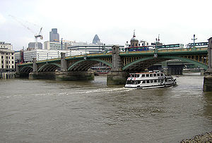
Nutzung Straßenbrücke Überführt Hauptstraße A300 Querung von Themse Ort London Konstruktion Bogenbrücke Gesamtlänge 197,5 m Freigabe 1. Brücke - 1819
2. Brücke - 1921Lage 

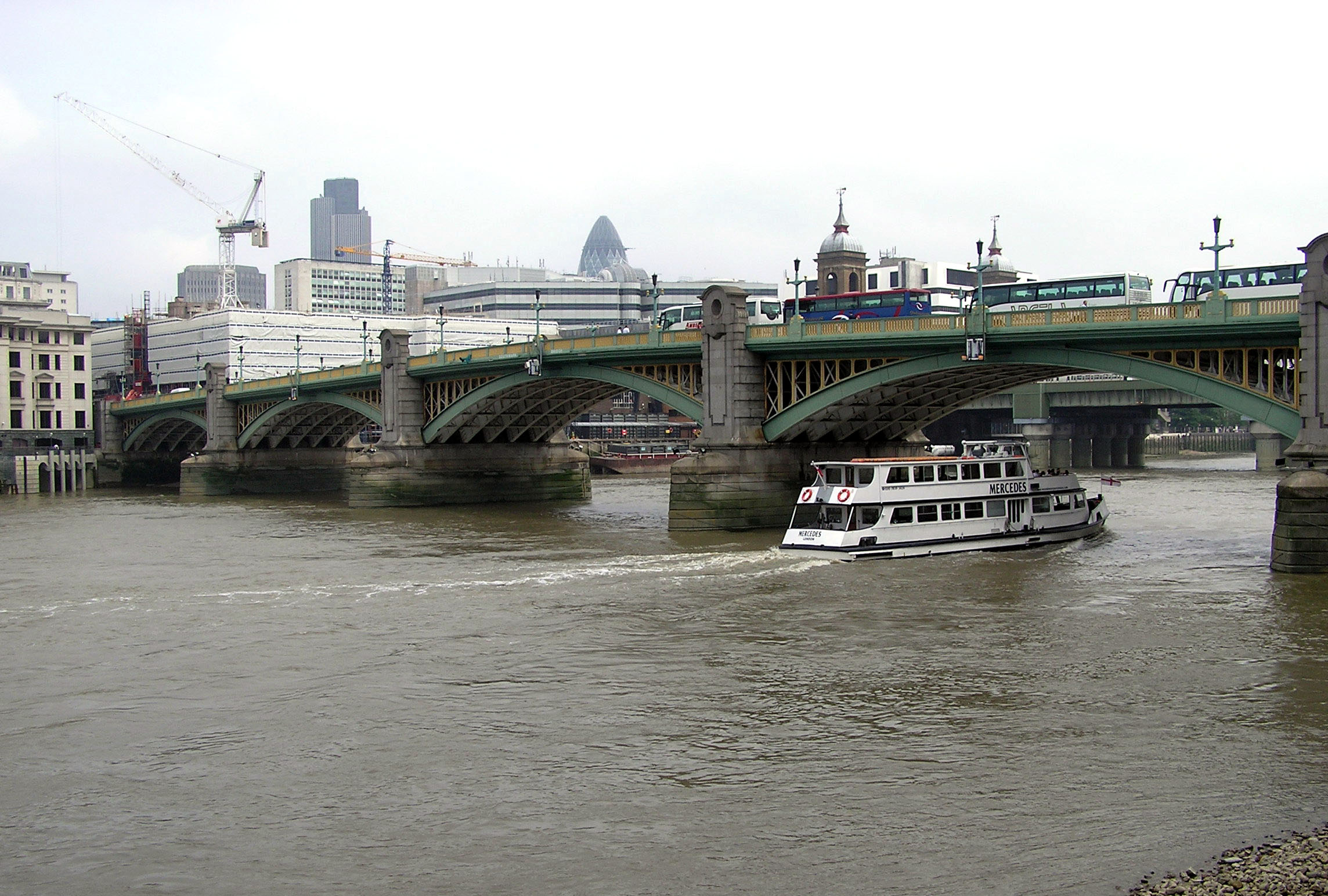
Die Southwark Bridge ist eine Straßenbrücke über den Fluss Themse in London. Sie verbindet die City of London auf der Nordseite mit dem Stadtteil Southwark im Stadtbezirk London Borough of Southwark auf der Südseite. Die Brücke ist 197,5 Meter lang und besteht aus fünf Stahlbögen. Die türmchenförmigen Pfeiler geben der Brücke ein eher altmodisches Aussehen. Am nördlichen Ufer befindet sich der Bahnhof Cannon Street, am südlichen Ufer das Tate Modern, das Globe Theatre und das Gebäude der Financial Times. Über die Brücke führt die Hauptstraße A300.
Die 1813 gegründete Southwark Bridge Company beauftragte den Bauingenieur John Rennie mit dem Bau einer neuen Brücke. Sie war Gegenstand heftiger Kontroversen: Die mächtige Corporation of London war grundsätzlich gegen eine mautpflichtige Brücke und die Flussschiffer befürchteten gefährliche Wasserstrudel. Dennoch konnte die Brücke aus Gusseisen im Jahr 1819 eröffnet werden. Allerdings wurde sie nur wenig genutzt. Gründe waren neben der Maut die unzureichenden Zufahrten und die holprige Fahrbahn.
Nach der Übernahme der Brücke durch Bridge House Estates, einer Wohlfahrtsorganisation der Corporation of London, wurde die Maut im Jahr 1864 aufgehoben. Dies führte zu einer derart starken Zunahme des Verkehrs, dass ein Neubau nötig wurde. 1913 begannen die Abrissarbeiten; die Eröffnung der neuen Brücke verzögerte sich jedoch wegen des Ersten Weltkriegs bis 1921.
Weblinks
 Commons: Southwark Bridge – Sammlung von Bildern, Videos und Audiodateien
flussaufwärts
Millennium BridgeFlussübergänge der Themse flussabwärts
Cannon Street Railway BridgeKategorien:- Brücke in London
- Straßenbrücke im Vereinigten Königreich
- Bogenbrücke im Vereinigten Königreich
- Stahlbrücke
- Themsebrücke
- Grade-II-Bauwerk (London)
- Erbaut in den 1810er Jahren
- Erbaut in den 1920er Jahren
- City of London
- Verkehr (London Borough of Southwark)

Wikimedia Foundation.