- Barobo
-
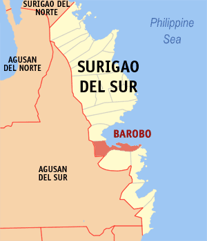
Municipality of Barobo Lage von Barobo in der Provinz Surigao del Sur 
Basisdaten Bezirk: Caraga Provinz: Surigao del Sur Barangays: 22 Distrikt: 2. Distrikt von Surigao del Sur PSGC: 166801000 Einkommensklasse: 3. Einkommensklasse Haushalte: 6482 Zensus 1. Mai 2000Einwohnerzahl: 40.933 Zensus 1. August 2007Koordinaten: 8° 33′ N, 126° 12′ O8.55126.2Koordinaten: 8° 33′ N, 126° 12′ O Postleitzahl: 8309 Offizielle Webpräsenz: www.barobo.gov.ph Geographische Lage auf den Philippinen 

Barobo Barobo ist eine philippinische Stadtgemeinde in der Provinz Surigao del Sur. Nach dem Zensus vom 1. Mai 2000 hat sie 34.558 Einwohner in 6482 Haushalten.
Baranggays
Barobo ist politisch in 22 Baranggays unterteilt.
- Amaga
- Bahi
- Cabacungan
- Cambagang
- Causwagan
- Dapdap
- Dughan
- Gamut
- Javier
- Kinayan
- Mamis
- Poblacion
- Guinhalinan
- Rizal
- San Jose
- San Roque
- San Vicente
- Sua
- Sudlon
- Tambis
- Unidad
- Wakat
Städte und Stadtgemeinden in der Provinz Surigao del SurStädte: Bislig City | Tandag City
Stadtgemeinden: Barobo | Bayabas | Cagwait | Cantilan | Carmen | Carrascal | Cortes | Hinatuan | Lanuza | Lianga | Lingig | Madrid | Marihatag | San Agustin | San Miguel | Tagbina | Tago (Surigao del Sur)
Wikimedia Foundation.
Schlagen Sie auch in anderen Wörterbüchern nach:
Barobo — Original name in latin Barobo Name in other language State code PH Continent/City Asia/Manila longitude 8.53528 latitude 126.12139 altitude 17 Population 9893 Date 2011 07 31 … Cities with a population over 1000 database
Barobo — Admin ASC 2 Code Orig. name Barobo Country and Admin Code LR.13.2278880 LR … World countries Adminstrative division ASC I-II
Barobo, Surigao del Sur — Barobo is a 4th class municipality in the province of Surigao del Sur, Philippines. According to the 2000 census, it has a population of 34,558 people in 6,482 households.BarangaysBarobo is politically subdivided into 22 barangays.External links* … Wikipedia
Cortes, Surigao del Sur — Map of Surigao del Sur showing the location of Cortes Cortes is a 4th class municipality in the province of Surigao del Sur, Philippines. According to the 2000 Philippine census, it has a population of 14,825 people in 2,742 households. Contents … Wikipedia
Surigao del Sur Polytechnic State College — Infobox University name = Surigao del Sur Polytechnic State College motto = Carving a name in the map of higher education established = 1982 under Bukidnon State College External Studies Center, 1992 Converted into Surigao del Sur Polytechnic… … Wikipedia
Cortes (Surigao del Sur) — Municipality of Cortes Lage von Cortes in der Provinz Surigao del Sur Basisdaten Bezirk … Deutsch Wikipedia
PH-SUR — Lage der Provinz Surigao del Sur Surigao del Sur ist die 56. Provinz des Inselstaates der Philippinen. Sie befindet sich an der nordöstlichen Küste der Insel Mindanao und gehört politisch dem Regierungsbezirk Caraga (Region XIII) an. Der Sitz der … Deutsch Wikipedia
Masbate — redirects here. For other uses, see Masbate (disambiguation). Masbate Province … Wikipedia
Surigao del Sur — Infobox Philippine province name = Surigao del Sur sealfile = Ph seal surigao del sur.png region = Caraga (Region XIII) capital = Tandag City founded = pop2000 = 501,808 pop2000rank = 49th largest popden2000 = 110 popden2000rank = 15th lowest… … Wikipedia
Butuan City — Infobox Philippine city infoboxtitle = City of Butuan | sealfile = Ph seal agusan del norte butuan.png locatormapfile = Ph locator agusan del norte butuan.png caption = Map of Agusan del Norte showing the location of Butuan City. Coordinates… … Wikipedia
Barobo

18+
© Academic, 2000-2024
- Kontaktieren Sie uns: Unterstützung, Werbung
Wörterbücher Export, schritte mit PHP, Joomla, Drupal, WordPress, MODx.