- Wasatch County
-
Verwaltung US-Bundesstaat: Utah Verwaltungssitz: Heber City Gründung: 1862 Demographie Einwohner: 23.530 (2010) Bevölkerungsdichte: 7,7 Einwohner/km² Geographie Fläche gesamt: 3.132 km² Wasserfläche: 82 km² Karte 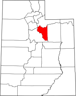
Wasatch County[1] ist ein County im Bundesstaat Utah der Vereinigten Staaten von Amerika. Der Sitz der Countyverwaltung (County Seat) ist Heber City.
Inhaltsverzeichnis
Geografie
Das Wasatch County hat eine Fläche von 3132 Quadratkilometern, davon sind 82 Quadratkilometer Wasserfläche. Es grenzt im Uhrzeigersinn an die Countys: Duchesne County, Utah County, Salt Lake County und Summit County.
Geschichte
Wasatch County wurde im Jahre 1862 gegründet. Es erhielt seinen Namen abgeleitet aus dem indianischen Wort für Bergpass.
Demografische Daten
Historische Einwohnerzahlen Census Einwohner ± in % 1870 1244 — 1880 2927 100 % 1890 3595 20 % 1900 4786 30 % 1910 8920 90 % 1920 4625 -50 % 1930 5636 20 % 1940 5754 2 % 1950 5574 -3 % 1960 5308 -5 % 1970 5863 10 % 1980 8523 50 % 1990 10.089 20 % 2000 15.215 50 % 2010 23.530 50 % Vor 1900[2]  Alterspyramide des Countys (Stand: 2000)
 Wasatch County (UT) Details
 Der Mount Timpanogos und das Deer Creek Reservoir
 Das Strawberry Reservoir
Nach der Volkszählung im Jahr 2000 lebten im Wasatch County 15.215 Menschen. Es gab 4.743 Haushalte und 3.870 Familien. Die Bevölkerungsdichte betrug 5 Einwohner pro Quadratkilometer. Ethnisch betrachtet setzte sich die Bevölkerung zusammen aus 95,62% Weißen, 0,22% Afroamerikanern, 0,43% amerikanischen Ureinwohnern, 0,30% Asiaten, 0,10% Bewohnern aus dem pazifischen Inselraum und 1,96% aus anderen ethnischen Gruppen; 1,38% stammten von zwei oder mehr ethnischen Gruppen ab. 5,09% der Bevölkerung waren spanischer oder lateinamerikanischer Abstammung.
Von den 4.743 Haushalten hatten 46,20% Kinder und Jugendliche unter 18 Jahre, die bei ihnen lebten. 71,00% waren verheiratete, zusammenlebende Paare, 7,50% waren allein erziehende Mütter. 18,40% waren keine Familien. 14,30% waren Singlehaushalte und in 5,00% lebten Menschen im Alter von 65 Jahren oder darüber. Die Durchschnittshaushaltsgröße betrug 3,18 und die durchschnittliche Familiengröße lag bei 3,55 Personen.
Auf das gesamte County bezogen setzte sich die Bevölkerung zusammen aus 34,20% Einwohnern unter 18 Jahren, 9,90% zwischen 18 und 24 Jahren, 29,00% zwischen 25 und 44 Jahren, 18,50% zwischen 45 und 64 Jahren und 8,40% waren 65 Jahre alt oder darüber. Das Durchschnittsalter betrug 30 Jahre. Auf 100 weibliche Personen kamen 103,30 männliche Personen, auf 100 Frauen im Alter ab 18 Jahren kamen statistisch 99,50 Männer.
Das jährliche Durchschnittseinkommen eines Haushalts betrug 49.612 USD, das Durchschnittseinkommen der Familien betrug 52.102 USD. Männer hatten ein Durchschnittseinkommen von 37.399 USD, Frauen 23.571 USD. Das Prokopfeinkommen betrug 19.869 USD. 5,20% der Bevölkerung und 4,20% der Familien lebten unterhalb der Armutsgrenze. 5,60% davon waren unter 18 Jahre und 4,00% waren 65 Jahre oder älter.
Städte und Orte
- Center Creek
- Charleston
- Cranmer
- Daniel
- Hailstone
- Heber City
- Hideout
- Independence
- Jordanelle
- Keetley
- Midway
- Mound City
- Soldier Summit
- Three Forks
- Timber Lakes
- Wallsburg
Einzelnachweise
- ↑ Wasatch County im Geographic Names Information System des United States Geological Survey. Abgerufen am 22. Februar 2011
- ↑ U.S. Census Bureau _ Census of Population and Housing. Abgerufen am 28. Februar 2011
- ↑ Auszug aus Census.gov. Abgerufen am 28. Februar 2011
- ↑ Auszug aus factfinder.census.gov Abgerufen am 28. Februar 2011
Weblinks
- Virtuelle Tour durch Wasatch County (englisch)

Liste der Countys in Utah
Beaver | Box Elder | Cache | Carbon | Daggett | Davis | Duchesne | Emery | Garfield | Grand | Iron | Juab | Kane | Millard | Morgan | Piute | Rich | Salt Lake | San Juan | Sanpete | Sevier | Summit | Tooele | Uintah | Utah | Wasatch | Washington | Wayne | Weber
Wikimedia Foundation.
Schlagen Sie auch in anderen Wörterbüchern nach:
Wasatch County — Admin ASC 2 Code Orig. name Wasatch County Country and Admin Code US.UT.051 US … World countries Adminstrative division ASC I-II
Wasatch County, Utah — Infobox U.S. County county = Wasatch County state = Utah seallink = Seal of Wasatch County map size = 150 founded year = 1862 seat wl = Heber largest city wl = Heber area total sq mi = 1209 area total km2 = 3132 area land sq mi = 1177 area land… … Wikipedia
National Register of Historic Places listings in Wasatch County, Utah — Location of Wasatch County in Utah This is a list of the National Register of Historic Places listings in Wasatch County, Utah. This is intended to be a complete list of the properties and districts on the National Register of Historic Places in… … Wikipedia
Wasatch Range — Geobox|Range name=Wasatch Range image caption=View of the Wasatch Range from the Salt Lake City Public Library country=United States state=Utah parent=Rocky Mountains highest=Mount Nebo highest elevation imperial=11928 highest lat d= | highest… … Wikipedia
Wasatch Front — The Wasatch Front is an urban area in the north central part of the U.S. state of Utah. It consists of a chain of cities and towns stretched along the Wasatch Range from approximately Santaquin in the south to Brigham City in the north. Roughly… … Wikipedia
Wasatch Junior High — Infobox High School name=Wasatch Junior High headmaster= principal=Douglas Bingham motto= Empowering students for success in tomorrow s global society , Do you have the WOJO? established=1959 type=Public School location=3450 East Oakview Drive… … Wikipedia
Wasatch-Cache National Forest — Infobox protected area | name=Wasatch Cache National Forest iucn category=VI caption= locator x=65 locator y=63 location=Utah, Idaho, and Wyoming, USA nearest city=Logan, UT area=1,607,177 acres (6,504 km²) governing body=U.S. Forest… … Wikipedia
Wasatch Back — The Wasatch Back is an area in the U.S. state of Utah located east of the Wasatch Front. It includes such cities as Park City, Heber, and Morgan. While originally a mining and agricultural region, it has experienced a rapid growth spurt through… … Wikipedia
Duchesne County, Utah — Location in the state of Utah … Wikipedia
Salt Lake County, Utah — Infobox U.S. County county = Salt Lake County state = Utah seal seallink map size = 150 founded year = 1852 seat wl = Salt Lake City largest city wl = Salt Lake City area total sq mi = 808 area total km2 = 2092 area land sq mi = 737 area land km2 … Wikipedia
Wasatch County


18+
© Academic, 2000-2024
- Kontaktieren Sie uns: Unterstützung, Werbung
Wörterbücher Export, schritte mit PHP, Joomla, Drupal, WordPress, MODx.