Lindis River

Lindis River
Lindis RiverVorlage:Infobox Fluss/GKZ_fehlt
Lage Region Otago, Südinsel (Neuseeland)
Flusssystem Clutha RiverVorlage:Infobox Fluss/FLUSSSYSTEM_falsch

Vorlage:Infobox Fluss/ABFLUSSWEG_fehltVorlage:Infobox Fluss/QUELLE_fehltVorlage:Infobox Fluss/QUELLHÖHE_fehlt

Mündung in Lindis Crossing in den Clutha River
-44.876202304069169.34075117111

44° 52′ 34″ S, 169° 20′ 27″ O-44.876202304069169.34075117111
Vorlage:Infobox Fluss/MÜNDUNGSHÖHE_fehltVorlage:Infobox Fluss/HÖHENUNTERSCHIED_fehltVorlage:Infobox Fluss/LÄNGE_fehltVorlage:Infobox Fluss/EINZUGSGEBIET_fehlt

Vorlage:Infobox Fluss/ABFLUSS_fehlt

Lindis River (Neuseeland)
Blue pog.svg
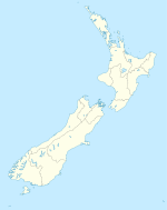
Lage des Lindis River in Neuseeland
Vorlage:Infobox Fluss/BILD_fehlt

Der Lindis River ist ein Fluss in der Region Otago auf der Südinsel Neuseelands.

Er ist ein linker Zufluss des Clutha River. Er fließt über den Lindis Pass 55 km in südliche Richtung. Der State Highway 8 folgt dem Tal des Flusses vom Pass bis kurz vor Tarras und mündet dann in Lindis Crossing nördlich des Lake Dunstan in den Clutha.

Einzelnachweise


Wikimedia Foundation.

Игры ⚽ Нужно сделать НИР?

Schlagen Sie auch in anderen Wörterbüchern nach:

  • Lindis River — The Lindis River is found in Otago in the South Island of New Zealand. It is a tributary of the Clutha River, flowing south for 55 kilometres through the Lindis Pass, site of the main inland road route between Otago and the Mackenzie Basin in… …   Wikipedia

  • Lindis Pass — xx Lindis Pass State Highway 8 Richtung Lindis Pass …   Deutsch Wikipedia

  • Lindis Pass — Infobox Mountain Pass Name = Lindis Pass Photo = NZ Lindis P.png Caption = Location of Lindis Pass Elevation = 971 m. Location = NZL Range = Southern Alps Coordinates = Topographic Traversed by = Lindis Pass (el. 972 m.) is located in the South… …   Wikipedia

  • Clutha River — / Mata Au The Clutha River system. Mouth Pacific Ocean Basin countries New Zealand Length …   Wikipedia

  • Makarora River — The Makarora River flows into northern end of Lake Wanaka. Origin Mount Aspiring National Park Mouth La …   Wikipedia

  • Matukituki River — The Matukituki River is found in the Southern Alps of New Zealand s South Island. It flows for 30 kilometres from Mount Aspiring National Park into the southwestern edge of Lake Wanaka just after passing under the West Wanaka bridge. The… …   Wikipedia

  • Clutha River — Der Clutha River in der Nähe von RoxburghVorlage:Infobox Fluss/KARTE fehlt Daten …   Deutsch Wikipedia

  • Manuherikia River — The Manuherikia River is located in Otago in the South Island of New Zealand. It rises in the far north of the Maniototo, flowing southwest for 85 kilometres before its confluence with the Clutha River at Alexandra. During the 1860s the… …   Wikipedia

  • Clutha River — River, New Zealand. The longest river in South Island, it rises in the Southern Alps and flows southeast 200 mi (320 km) to the sea. Its valley supports sheep, beef, grain, and fruit farming in the upper reaches and vegetable and dairy farming in …   Universalium

  • Cromwell, New Zealand — Cromwell …   Wikipedia

Share the article and excerpts

Direct link
Do a right-click on the link above
and select “Copy Link”