Kentwood (Louisiana)

Kentwood (Louisiana)
Kentwood
Spitzname: The Dairy Capital of the South
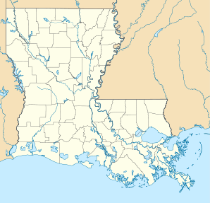
Kentwood (Louisiana)
Kentwood
Kentwood
Lage in Louisiana
Basisdaten
Gründung: 1893
Staat: Vereinigte Staaten
Bundesstaat: Louisiana
Parish:

Tangipahoa Parish

Koordinaten: 30° 56′ N, 90° 31′ W30.936111111111-90.51527777777864Koordinaten: 30° 56′ N, 90° 31′ W
Zeitzone: Central Standard Time (UTC−6)
Einwohner: 2205 (Stand: 2000)
Bevölkerungsdichte: 123,2 Einwohner je km²
Fläche: 17,9 km² (ca. 7 mi²)
davon 17,9 km² (ca. 7 mi²) Land
Höhe: 64 m
Postleitzahl: 70444
Vorwahl: +1 985
FIPS: 22-39545
GNIS-ID: 543352
Webpräsenz: www.kentwoodla.org
Bürgermeister: Harold Smith

Kentwood ist eine Kleinstadt im Tangipahoa Parish im US-amerikanischen Bundesstaat Louisiana und liegt etwa 50 Kilometer nördlich von New Orleans.

Inhaltsverzeichnis

Bevölkerung

Nach der Volkszählung des Jahres 2000 beträgt die Einwohnerzahl 2.205, davon sind 44.5 % Männer und 55.5 % Frauen. Das Durchschnittsalter der Bürger von Kentwood beträgt 33,5 Jahre. 64,9 % der Einwohner sind Afroamerikaner und 34,4 % Weiße. Das durchschnittliche jährliche Einkommen pro Haushalt liegt mit 17.297 Dollar weit unter dem US-Durchschnitt (41.994 Dollar). Etwa 37,6 % der Gesamtbevölkerung leben unterhalb der Armutsgrenze. Damit ist der Anteil der Armen wesentlich höher als im US-Durchschnitt (12,4 %).[1]

Bekannte Bewohner

Einzelnachweise

  1. Kentwood town, Louisiana. In: Census Bureau Home Page. U. S. Census Bureau, abgerufen am 26. August 2009 (englisch).

Weblinks

The Historic Town of Kentwood, Louisiana. Abgerufen am 26. August 2009.


Wikimedia Foundation.

Игры ⚽ Нужно решить контрольную?

Schlagen Sie auch in anderen Wörterbüchern nach:

  • Kentwood, Louisiana — Geobox Town name = Town of Kentwood native name = other name = other name1 = category = Town image size = image caption = flag size = symbol = symbol size = symbol type = nickname = The Dairy Capital of the South motto = country = United States… …   Wikipedia

  • Kentwood — is the name of two places and one school in the United States:*Kentwood, Louisiana *Kentwood, Michigan *Kentwood High School is a Senior High School in the Kent School District in Covington, Washingtonand a place in the United Kingdom:*Kentwood,… …   Wikipedia

  • Louisiana locations by per capita income — Louisiana has the forty seventh highest per capita income in the United States of America, at $16,912 (2000). Its personal per capita income is $26,100 (2003). Louisiana parishes ranked by per capita income There are sixty four parishes located… …   Wikipedia

  • Kentwood — ist der Name folgender Orte: Kentwood (Louisiana) Kentwood (Michigan) Diese Seite ist eine Begriffsklärung zur Unterscheidung mehrerer mit demselben Wort bezeichneter Begriffe …   Deutsch Wikipedia

  • Kentwood — Kentwood, LA U.S. town in Louisiana Population (2000): 2205 Housing Units (2000): 979 Land area (2000): 6.924794 sq. miles (17.935133 sq. km) Water area (2000): 0.005553 sq. miles (0.014381 sq. km) Total area (2000): 6.930347 sq. miles (17.949514 …   StarDict's U.S. Gazetteer Places

  • Kentwood, LA — U.S. town in Louisiana Population (2000): 2205 Housing Units (2000): 979 Land area (2000): 6.924794 sq. miles (17.935133 sq. km) Water area (2000): 0.005553 sq. miles (0.014381 sq. km) Total area (2000): 6.930347 sq. miles (17.949514 sq. km) FIPS …   StarDict's U.S. Gazetteer Places

  • Louisiana Highway 1049 — Infobox LA Highway type=State route=1049 length mi=5.63 length round=2 formed= dir1=South dir2=North from= to= previous type=State previous route=1048 next type=State next route=1050 Louisiana Highway 1049 (LA 1049) is a state highway in… …   Wikipedia

  • Louisiana Highway 1051 — Infobox LA Highway type=State route=1051 length mi=3.18 length round=2 formed= dir1=South dir2=North from= to= previous type=State previous route=1050 next type=State next route=1052 Louisiana Highway 1051 (LA 1051) is a state highway in… …   Wikipedia

  • Louisiana Highway 1053 — Infobox LA Highway type=State route=1053 length mi=5.60 length round=2 formed= dir1=South dir2=North from= to=End of State Maintenance at the Mississippi State Line previous type=State previous route=1052 next type=State next route=1054 Louisiana …   Wikipedia

  • Louisiana Highway 1050 — Infobox LA Highway type=State route=1050 length mi=4.96 length round=2 formed= dir1=South dir2=North from= to= previous type=State previous route=1049 next type=State next route=1051 Louisiana Highway 1050 (LA 1050) is a state highway in… …   Wikipedia

Share the article and excerpts

Direct link
Do a right-click on the link above
and select “Copy Link”