Apostag

Apostag
Apostag
Wappen von Apostag
Apostag (Ungarn)
Paris plan pointer b jms.svg
Basisdaten
Staat: Ungarn
Region: Dél-Alföld (Südliche Große Tiefebene)
Komitat: Bács-Kiskun
Kleingebiet: Kunszentmiklós
Koordinaten: 46° 53′ N, 18° 58′ O46.88118.959869444444Koordinaten: 46° 52′ 52″ N, 18° 57′ 36″ O
Fläche: 31,94 km²
Einwohner: 2.035 (1. Jän. 2010)
Bevölkerungsdichte: 64 Einwohner je km²
Telefonvorwahl: (+36) 78
Postleitzahl: 6088
KSH kódja: 21148

Apostag ist ein kleines Dorf und eine Gemeinde in Ungarn im Komitat Bács-Kiskun neben der Donau. Die Bevölkerungszahl beträgt etwa 2.130 Einwohner. Die Gemeinde hat eine Fläche von 31,94 km².

Inhaltsverzeichnis

Lage

Apostag liegt etwa 75 Kilometer südlich von Budapest und 35 km östlich des Balatonsees an der Europastraße E 73.

Sehenswertes

  • Das örtliche Museum Nagy Lajos Emlékkiállítás.
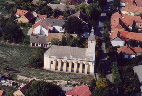
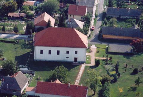
  • Die Synagoge aus dem Jahr 1820 wurde nach einem Großbrand wieder aufgebaut. Sie wird mit ihrer frühen Bauzeit, ihrer Raumgestaltung und der Innendekoration zu den wichtigsten Synagogen Ungarns gezählt und erhielt im Jahre 1988 den Europa-Nostra-Preis für die Erhaltung der europäischen Kultur[1].

Bilder

Weblinks

Quellen

  1. http://www.hagalil.com/galluth/apostat.htm

Wikimedia Foundation.

Игры ⚽ Нужна курсовая?

Schlagen Sie auch in anderen Wörterbüchern nach:

  • Apostag — Héraldique Administration …   Wikipédia en Français

  • Apostag — Infobox Settlement settlement type = subdivision type = Country subdivision name = HUN latd= |latm= |lats= |latNS=N longd= |longm= |longs= |longEW=Epushpin pushpin label position = pushpin map caption = pushpin mapsize = timezone=CET utc… …   Wikipedia

  • Apostag — Original name in latin Apostag Name in other language Apostag State code HU Continent/City Europe/Budapest longitude 46.88208 latitude 18.9621 altitude 97 Population 2099 Date 2012 05 06 …   Cities with a population over 1000 database

  • Апоштаг — Посёлок Апоштаг венг. Apostag Герб …   Википедия

  • Kleingebiet Kunszentmiklos — Koordinaten fehlen! Hilf mit. Das Kleingebiet Kunszentmiklós (ungarisch Kunszentmiklósi kistérség) ist eine ungarische Verwaltungseinheit (LAU 1) innerhalb des Komitats Bács Kiskun. Der Verwaltungssitz ist in Kunszentmiklós. Gemeinden Apostag… …   Deutsch Wikipedia

  • SYNAGOGUE — This article is arranged according to the following outline. origins and history until the first century first century c.e. middle ages modern period …   Encyclopedia of Judaism

  • Bács-Kiskun County — Infobox Hungarian county name =Bács Kiskun region =Southern Great Plain seat = Kecskemét area = 8,445 population = 534,000 density = 63 cities = 119Bács Kiskun is a county ( megye in Hungarian; IPA2|baːtʃ kiʃkun) located in southern Hungary. It… …   Wikipedia

  • Csávoly — Csávoly …   Wikipedia

  • Dunavecse — Coat of arms …   Wikipedia

  • Dunapataj — Dunapataj …   Wikipedia

Share the article and excerpts

Direct link
Do a right-click on the link above
and select “Copy Link”