Tanana Hills

Tanana Hills

p1f1

Tanana Hills
Höchster Gipfel Mount Eldridge (1.905 m)
Lage Alaska (USA)
Tanana Hills (Alaska)
Tanana Hills
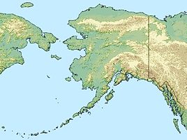
Koordinaten 65° 0′ N, 149° 0′ W65-1491905Koordinaten: 65° 0′ N, 149° 0′ W

Die Tanana Hills (auch Yukon-Tanana Highlands oder Yukon-Tanana Upland genannt) sind ein 360 km langes Gebirge im Interior von Alaska. Sie erstrecken sich zwischen Tanana und Yukon River von den Minto Flats im Westen bis zur Grenze zum kanadischen Territorium Yukon im Osten.

Im Norden geht das Gebirge in das breite Tal des Yukon und das Yukon Flats National Wildlife Refuge über. Im Süden liegt das Tanana Valley, die am dichtesten bevölkerte Region Alaskas nördlich der Alaskakette.

Gebirgszüge innerhalb der Tanana Hills sind die Ray und die White Mountains. Im White Mountains National Recreation Area liegt der Oberlauf des Beaver Creek und im Steese National Conservation Area der des Birch Creek. Beide Flüsse sind als National Wild and Scenic Rivers ausgewiesen. Der höchste Berg ist der Mount Eldridge mit 1.905 m.

Der Steese Highway von Fairbanks nach Circle durchquerst die Tanana Hills.

Weblinks


Wikimedia Foundation.

Игры ⚽ Нужна курсовая?

Schlagen Sie auch in anderen Wörterbüchern nach:

  • Tanana — steht für: Tanana (Volk), Ureinwohner Alaskas Tanana (Alaska), eine Siedlung in Alaska Tanana River, einen Fluss in Alaska Tanana Hills, ein Gebirge in Alaska Tanana Valley, eine Region nördlich der Alaskakette Tanana Valley Railroad, eine… …   Deutsch Wikipedia

  • Tanana (soil) — The Tanama soil is the official state soil of Alaska.ProfileThe Tanama soil consists of shallow, well drained, moderately permeable soils formed in materials weathered from limestone. They are gently sloping to very steep soils on foot slopes and …   Wikipedia

  • Yukon-Tanana Highlands — Die Tanana Hills (auch Yukon Tanana Highlands oder Yukon Tanana Upland genannt) sind ein 360 km langes Gebirge im Interior von Alaska. Sie erstrecken sich zwischen Tanana und Yukon River von den Minto Flats im Westen bis zur Grenze zum… …   Deutsch Wikipedia

  • Yukon-Tanana Upland — Die Tanana Hills (auch Yukon Tanana Highlands oder Yukon Tanana Upland genannt) sind ein 360 km langes Gebirge im Interior von Alaska. Sie erstrecken sich zwischen Tanana und Yukon River von den Minto Flats im Westen bis zur Grenze zum… …   Deutsch Wikipedia

  • Frank Tanana — Infobox MLB retired name=Frank Tanana position=Pitcher bats=Left throws=Left birthdate=birth date and age|1953|7|3 city state|Detroit|Michigan debutdate=September 9 debutyear=by|1973 debutteam=California Angels finaldate=October 1… …   Wikipedia

  • White Mountains (Alaska) — p1p3 White Mountains Eagle Summit in den White Mountains Lage Alaska (USA) …   Deutsch Wikipedia

  • Fairbanks mining district — Infobox Settlement name = Fairbanks mining district official name = settlement type = Alaska Mining District nickname = motto = |pushpin pushpin label position =left pushpin map caption = pushpin mapsize = mapsize = map caption = mapsize1 = map… …   Wikipedia

  • Hess Creek — Hess CreekVorlage:Infobox Fluss/GKZ fehlt Lage Alaska Flusssystem Yukon River Vorlage:Infobox Fluss/ABFLUSSWEG fehlt Quellgebiet Tanana H …   Deutsch Wikipedia

  • District of Alaska — This article refers to Alaska in the period from 1884 to 1912. For the federal court sometimes called District of Alaska , see United States District Court for the District of Alaska. District of Alaska District of the United States …   Wikipedia

  • Birch Creek — Birch CreekVorlage:Infobox Fluss/GKZ fehlt Lage Alaska Flusssystem YukonVorlage:Infobox Fluss/FLUSSSYSTEM falsch Vorlage:Infobox Fluss/ABFLUSSWEG fehlt Quel …   Deutsch Wikipedia

Share the article and excerpts

Direct link
Do a right-click on the link above
and select “Copy Link”