Yengema

Yengema
Wappen Karte
Wappen fehlt
Karte Sierra Leone
Basisdaten
Region/Provinz: Eastern Province
Distrikt: Kono
Höhe: 396 m. ü. NN
Fläche Stadt: ?? km² [1]
Fläche Distrikt: 5.641 km² [2]
Fläche Provinz: 15.553 km² [2]
Einwohner Stadt: 10.970 (Schätzung 2007) [2]
Einwohner Distrikt: 330.386 (Schätzung 2007) [2]
Einwohner Provinz: 1.211.482 (Schätzung 2007) [2]
Bevölkerungsdichte Stadt: ?? Einwohner je km²
Bevölkerungsdichte Distrikt: 58,6 Einwohner je km²
Bevölkerungsdichte Provinz: 77,9 Einwohner je km²
Vorwahl: (+232) (0)571
Stadtgliederung: keine
Adresse der
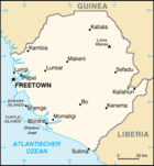
Stadtverwaltung:
Yengema Council, Kono District, Eastern Province
Webpräsenz: z.Zt. keine
Bürgermeister: k.A.
UN/LOCODE: k.A.

Yengema ist eine Kleinstadt im Distrikt Kono der Eastern Province in Sierra Leone. Die Hauptindustrie in der Region ist der Bergbau, primär Diamantenabbau. Die Einwohnerzahl betrug 2007 ca. 10.000.

Der Hauptflughafen des Distriktes (IATA-Code „WYE“, ICAO-Code „GFYE“) liegt in Yengema. Er hat eine 940 Meter lange Start- und Landebahn.

Weblinks

Quellen

  1. Yengema EPL
  2. a b c d e World Gazetteer: [1], 8. Januar 2007

Siehe auch

8.72-11.17

Wikimedia Foundation.

Игры ⚽ Поможем написать курсовую

Schlagen Sie auch in anderen Wörterbüchern nach:

  • Yengema — Infobox Settlement official name = Yengema, Kono District other name = native name = nickname = settlement type = motto = imagesize = image caption = flag size = image seal size = image shield = shield size = image blank emblem = blank emblem… …   Wikipedia

  • Yengema — Original name in latin Yengema Name in other language WYE, Yengema State code SL Continent/City Africa/Freetown longitude 8.71667 latitude 11.16667 altitude 388 Population 11221 Date 2012 01 18 …   Cities with a population over 1000 database

  • Yengema Airport — Infobox Airport name = Yengema Airport IATA = WYE ICAO = GFYE type = Regional operator = Sierra Leonean Airports Authority city served = Yengema elevation f = 1300 elevation m = 396 coordinates = coord|08|36|55.11|N|11|02|49.89|W|type:airport r1… …   Wikipedia

  • Yengema Secondary School — Infobox UK school name = Yengema Secondary School (YSS) motto = motto pl = established = 1941 approx = closed = c approx = type = Public School religion = Roman Catholic president = head label = head = r head label = r head = founder = street =… …   Wikipedia

  • Yengema — ▪ Sierra Leone       town, east central Sierra Leone. The headquarters of a diamond mining area inhabited mainly by the Kono and Mandingo peoples, the town has diamond washing plants, a hospital, and several schools. Pop. (latest est.) 12,938. *… …   Universalium

  • Yengema — Yengẹma,   Stadt im östlichen Sierra Leone, 24 000 Einwohner; Zentrum der Diamantengewinnung; Flugplatz …   Universal-Lexikon

  • WYE — Yengema, Sierra Leone internationale Flughafen Kennung …   Acronyms

  • WYE — Yengema, Sierra Leone internationale Fughafen Kennung …   Acronyms von A bis Z

  • Kono District — Infobox City official name = Kono District subdivision type = Country subdivision type1 = Capital subdivision type2 = Province subdivision name = Sierra Leone subdivision name1 = Koidu Town subdivision name2 = Eastern Province leader title =… …   Wikipedia

  • Freetown-Hastings — Hastings Airfield Freetown …   Deutsch Wikipedia

Share the article and excerpts

Direct link
Do a right-click on the link above
and select “Copy Link”