- Trstice
-
Trstice
Wappen Karte 
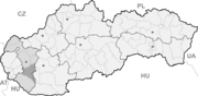

Trstice BasisdatenKraj: Trnavský kraj Okres: Galanta Region: Dolné Považie Fläche: 20,266 km² Einwohner: 3.822 (31. Dez. 2010) Bevölkerungsdichte: 188,59 Einwohner je km² Höhe: 114 m n.m. Postleitzahl: 925 42 Telefonvorwahl: 0 31 Geographische Lage: 48° 1′ N, 17° 48′ O48.01666666666717.804166666667114Koordinaten: 48° 1′ 0″ N, 17° 48′ 15″ O Kfz-Kennzeichen: GA Gemeindekennziffer: 504106 StrukturGemeindeart: Gemeinde Verwaltung (Stand: Februar 2011)Bürgermeister: František Juhos Adresse: Obecný úrad Trstice
667
92542 TrsticeWebpräsenz: www.trstice.sk Gemeindeinformation
auf portal.gov.skStatistikinformation
auf statistics.skTrstice (ungarisch Nádszeg) ist eine Gemeinde im Trnavský kraj im Südwesten der Slowakei.
Geographie
Die Gemeinde liegt in der flachen Donauebene im Donautiefland zwischen den Flüssen Kleine Donau und Čierna voda, 19 km von Dunajská Streda und 23 km von Galanta entfernt. Manchmal wird die Gegend auch als Mattesland bezeichnet.
Geschichte
Die Gemeinde wurde zum ersten Mal 1608 als Nagy Szegh erwähnt, nachdem der Ort kurz zuvor, in den Jahren 1594–96, gegründet worden war. Der Name soll laut Matthias Bel auf die großen Schilfvorkommen um den Ort herum hinweisen. Im späteren 17. Jahrhundert wurde die Gemeinde mehrmals durch türkische Angriffe und anti-habsburgische Aufstände verwüstet. Sie konnte sich dennoch zu einer der größten Gemeinden in der Gegend entwickeln.
Bis 1918/1919 befand sich die Gemeinde im Komitat Pressburg im Königreich Ungarn, danach kam sie zur neu entstandenen Tschechoslowakei. 1938–1945 war sie als Folge des Ersten Wiener Schiedsspruchs noch einmal Teil Ungarns.
Der fast zur Gänze von ungarischstämmigen Einwohnern bewohnte Ort bekam 1948 aus nationalpolitischen Gründen den analog dem ungarischen Namen geformten slowakischen Namen Trstice (trstina (slowakisch) = nád (ungarisch) = Schilf).
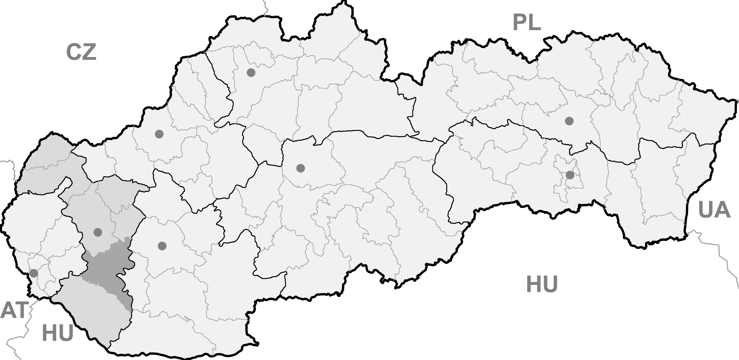
Gemeinden im Okres GalantaAbrahám | Čierna Voda (Schwarzwasser) | Čierny Brod | Dolná Streda | Dolné Saliby | Dolný Chotár | Galanta | Gáň | Horné Saliby | Hoste (Gest) | Jánovce | Jelka | Kajal | Košúty | Kráľov Brod | Malá Mača | Matúškovo | Mostová | Pata | Pusté Sady | Pusté Úľany | Sereď | Sládkovičovo (Diosek) | Šalgočka | Šintava (Schintau) | Šoporňa | Tomášikovo | Topoľnica | Trstice | Váhovce | Veľká Mača | Veľké Úľany | Veľký Grob (Deutsch-Eisgrub) | Vinohrady nad Váhom | Vozokany | Zemianske Sady
Wikimedia Foundation.
Schlagen Sie auch in anderen Wörterbüchern nach:
Trstice — (Village) Administration Pays Slovaquie … Wikipédia en Français
Trstice — Location of Galanta District in the Trnava Region Trstice (Hungarian: Nádszeg) is a large village and municipality in Galanta District of the Trnava Region of south west Slovakia. History … Wikipedia
Galanta District — District Country Slovakia … Wikipedia
Trnava Region — Geobox | Region name = Trnava category = Region image caption = image caption = symbol = symbol type = etymology = official name = motto = nickname = country = Slovakia country state = region = district = commune = municipality = border = part… … Wikipedia
Dolná Streda — Coordinates: 48°16′11″N 17°45′15″E / 48.26972°N 17.75417°E / 48.26972; 17.75417 … Wikipedia
List of municipalities and towns in Slovakia — Slovakia This is a comprehensive list of municipalities and towns in Slovakia. For lists of towns and municipalities sorted by Regions see the individual articles on Regions. For an outdated list of towns only in Slovakia see also List of towns… … Wikipedia
Zemianske Sady — Location of Galanta District in the Trnava Region Zemianske Sady (old form: Nemeškert; Hungarian: Nemeskürt) is a village and municipality in Galanta District of the Trnava Region of south west Slovakia … Wikipedia
Sládkovičovo — For the Romanian village of Tuta, called Diószeg in Hungarian, see Târgu Trotuş. Coordinates: 48°12′19″N 17°38′39″E / 48.20528°N 17.64417°E … Wikipedia
Čierna Voda — Location of Galanta District in the Trnava Region Čierna Voda (Hungarian: Feketenyék) is a village and municipality in Galanta District of the Trnava Region of south west Slovakia. History … Wikipedia
Čierny Brod — Location of Galanta District in the Trnava Region Čierny Brod (Hungarian: Vízkelet) is a village and municipality in Galanta District of the Trnava Region of south west Slovakia. History … Wikipedia
Trstice

18+
© Academic, 2000-2024
- Kontaktieren Sie uns: Unterstützung, Werbung
Wörterbücher Export, schritte mit PHP, Joomla, Drupal, WordPress, MODx.