- Le Thour
-
Le Thour 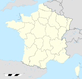

Region Champagne-Ardenne Département Ardennes Arrondissement Rethel Kanton Asfeld Gemeindeverband Communauté de communes de l'Asfeldois Koordinaten 49° 32′ N, 4° 5′ O49.5391666666674.089444444444479Koordinaten: 49° 32′ N, 4° 5′ O Höhe 79 m (70–129 m) Fläche 16,62 km² Einwohner 325 (1. Jan. 2008) Bevölkerungsdichte 20 Einw./km² Postleitzahl 08190 INSEE-Code 08451 Le Thour ist eine französische Gemeinde mit 325 Einwohnern (Stand 1. Januar 2008) im Département Ardennes in der Region Champagne-Ardenne; sie gehört zum Arrondissement Rethel und zum Kanton Asfeld.
Geschichte
Bevölkerungsentwicklung
- 1962: 312
- 1968: 377
- 1975: 333
- 1982: 303
- 1990: 351
- 1999: 317
Ab 1962 nur Einwohner mit Erstwohnsitz
Aire | Asfeld | Avaux | Balham | Bergnicourt | Blanzy-la-Salonnaise | Brienne-sur-Aisne | Gomont | Houdilcourt | L'Écaille | Le Thour | Poilcourt-Sydney | Roizy | Saint-Germainmont | Saint-Remy-le-Petit | Sault-Saint-Remy | Vieux-lès-Asfeld | Villers-devant-le-Thour
Wikimedia Foundation.
Schlagen Sie auch in anderen Wörterbüchern nach:
thour — þour, thourch, thourgh, þourȝ, thourh, þourh, thourth, obs. ff. through … Useful english dictionary
Villers-devant-le-thour — Pour les articles homonymes, voir Villers. Villers devant le Thour … Wikipédia en Français
CR Beni-Thour — CR Béni Thour CR Béni Thour … Wikipédia en Français
CR Beni Thour — CR Béni Thour CR Béni Thour … Wikipédia en Français
CR Béni Thour — CR Béni Thour … Wikipédia en Français
Le Thour — 49° 32′ 23″ N 4° 05′ 25″ E / 49.5397, 4.0903 … Wikipédia en Français
Chabab Riadhi Béni Thour — Infobox club sportif CR Béni Thour Pas de logo ? Importez le logo de ce club. Généralités Nom complet Chabab Riadhi Béni Thour … Wikipédia en Français
Villers-devant-le-Thour — Pour les articles homonymes, voir Villers. 49° 30′ 29″ N 4° 05′ 13″ E … Wikipédia en Français
Le Thour — País … Wikipedia Español
Villers-devant-le-Thour — País … Wikipedia Español
Le Thour

18+
© Academic, 2000-2024
- Kontaktieren Sie uns: Unterstützung, Werbung
Wörterbücher Export, schritte mit PHP, Joomla, Drupal, WordPress, MODx.