- Walworth County (South Dakota)
-
Verwaltung US-Bundesstaat: South Dakota Verwaltungssitz: Selby Gründung: 1873 Demographie Einwohner: 5974 (2000) Bevölkerungsdichte: 3,3 Einwohner/km² Geographie Fläche gesamt: 1.928 km² Wasserfläche: 94 km² Karte 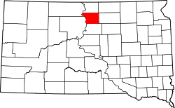
 Bethany Lutheran Church in Selby
Walworth County[1] ist ein County im Bundesstaat South Dakota der Vereinigten Staaten von Amerika. Der Sitz der Countyverwaltung (County Seat) ist in Selby.
Inhaltsverzeichnis
Geographie
Das County hat eine Fläche von 1928 Quadratkilometern; davon sind 94 Quadratkilometer (4,98 Prozent) Wasserflächen. Das County ist ein zwei unorganisierte Gebiete eingeteilt: East Walworth und West Walworth.
Bevölkerungsentwicklung
Historische Einwohnerzahlen Census Einwohner ± in % 1900 3839 — 1910 6488 70 % 1920 8447 30 % 1930 8791 4 % 1940 7274 -20 % 1950 7648 5 % 1960 8097 6 % 1970 7842 -3 % 1980 7011 -10 % 1990 6087 -10 % 2000 5974 -2 % 2010 5438 -9 % 1900–1990[2] 2000[3]
Städte und Gemeinden
Städte (Citys)
- Mobridge
- Selby
Gemeinden (Towns):
- Akaska
- Glenham
- Java
- Lowry
Einzelnachweise
- ↑ Walworth County im Geographic Names Information System des United States Geological Survey. Abgerufen am 22. Februar 2011
- ↑ Auszug aus Census.gov. Abgerufen am 28. Februar 2011
- ↑ Auszug aus factfinder.census.gov Abgerufen am 28. Februar 2011

Liste der Countys in South Dakota
Aurora | Beadle | Bennett | Bon Homme | Brookings | Brown | Brule | Buffalo | Butte | Campbell | Charles Mix | Clark | Clay | Codington | Corson | Custer | Davison | Day | Deuel | Dewey | Douglas | Edmunds | Fall River | Faulk | Grant | Gregory | Haakon | Hamlin | Hand | Hanson | Harding | Hughes | Hutchinson | Hyde | Jackson | Jerauld | Jones | Kingsbury | Lake | Lawrence | Lincoln | Lyman | Marshall | McCook | McPherson | Meade | Mellette | Miner | Minnehaha | Moody | Pennington | Perkins | Potter | Roberts | Sanborn | Shannon | Spink | Stanley | Sully | Todd | Tripp | Turner | Union | Walworth | Yankton | Ziebach
Wikimedia Foundation.
Schlagen Sie auch in anderen Wörterbüchern nach:
Walworth County, South Dakota — Infobox U.S. County county = Walworth County state = South Dakota founded year = founded date = seat wl = Selby largest city wl = area total sq mi = 744 area total km2 = 1928 area land sq mi = 708 area land km2 = 1833 area water sq mi = 36 area… … Wikipedia
National Register of Historic Places listings in Walworth County, South Dakota — Location of Walworth County in South Dakota This is a list of the National Register of Historic Places listings in Walworth County, South Dakota. This is intended to be a complete list of the properties on the National Register of Historic Places … Wikipedia
Edmunds County, South Dakota — Location in the state of South Dakota … Wikipedia
Dewey County, South Dakota — Location in the state of South Dakota … Wikipedia
Corson County, South Dakota — Corson County Courthouse in McIntosh, South Dakota in 1993. This building was destroyed by fire on April 10, 2006 … Wikipedia
Minnehaha County (South Dakota) — Verwaltung US Bundesstaat: South Dakota Verwaltungssitz: Sioux Falls Adresse des Verwaltungssitzes: Gründung … Deutsch Wikipedia
Ziebach County (South Dakota) — Verwaltung US Bundesstaat: South Dakota Verwaltungssitz: Dupree Adresse des Verwaltungssitzes: Gründung … Deutsch Wikipedia
Campbell County, South Dakota — Infobox U.S. County county = Campbell County state = South Dakota founded year = 1883 [ Legislative Manual, South Dakota, 2005, p. 596] founded date = seat wl = Mound City largest city wl = Herreid area total sq mi = 771 area total km2 = 1998… … Wikipedia
Potter County, South Dakota — Infobox U.S. County county = Potter County state = South Dakota founded year = founded date = seat wl = Gettysburg largest city wl = area total sq mi = 898 area total km2 = 2327 area land sq mi =866 area land km2 = 2244 area water sq mi = 32 area … Wikipedia
Minnehaha County, South Dakota — Minnehaha County Courthouse in Sioux Falls, South Dakota … Wikipedia
Walworth County (South Dakota)


18+
© Academic, 2000-2024
- Kontaktieren Sie uns: Unterstützung, Werbung
Wörterbücher Export, schritte mit PHP, Joomla, Drupal, WordPress, MODx.