- Marshall County (South Dakota)
-
Verwaltung US-Bundesstaat: South Dakota Verwaltungssitz: Britton Gründung: 1885 Demographie Einwohner: 4576 (2000) Bevölkerungsdichte: 2,1 Einwohner/km² Geographie Fläche gesamt: 2.294 km² Wasserfläche: 124 km² Karte 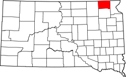
Marshall County[1] ist ein County im Bundesstaat South Dakota der Vereinigten Staaten von Amerika. Der Sitz der Countyverwaltung (County Seat) ist in Britton.
Inhaltsverzeichnis
Geographie
Das County hat eine Fläche von 2294 Quadratkilometern; davon sind 124 Quadratkilometer (5,41 Prozent) Wasserflächen. Er wird in 25 Townships eingeteilt: Buffalo, Dayton, Dumarce, Eden, Fort, Hamilton, Hickman, La Belle, Lake, Lowell, McKinley, Miller, Newark, Newport, Nordland, Pleasant Valley, Red Iron Lake, Sisseton, Stena, Veblen, Victor, Waverly, Weston, White und Wismer.
Bevölkerungsentwicklung
Historische Einwohnerzahlen Census Einwohner ± in % 1900 5942 — 1910 8021 30 % 1920 9596 20 % 1930 9540 -0,6 % 1940 8880 -7 % 1950 7835 -10 % 1960 6663 -10 % 1970 5965 -10 % 1980 5404 -9 % 1990 4844 -10 % 2000 4576 -6 % 2010 4656 2 % 1900–1990[2] 2000[3]
Städte und Gemeinden
Städte (cities)
- Britton
- Veblen
Gemeinden (towns)
- Eden
- Lake City
- Langford
Einzelnachweise
- ↑ Marshall County im Geographic Names Information System des United States Geological Survey. Abgerufen am 22. Februar 2011
- ↑ Auszug aus Census.gov. Abgerufen am 28. Februar 2011
- ↑ Auszug aus factfinder.census.gov Abgerufen am 28. Februar 2011

Liste der Countys in South Dakota
Aurora | Beadle | Bennett | Bon Homme | Brookings | Brown | Brule | Buffalo | Butte | Campbell | Charles Mix | Clark | Clay | Codington | Corson | Custer | Davison | Day | Deuel | Dewey | Douglas | Edmunds | Fall River | Faulk | Grant | Gregory | Haakon | Hamlin | Hand | Hanson | Harding | Hughes | Hutchinson | Hyde | Jackson | Jerauld | Jones | Kingsbury | Lake | Lawrence | Lincoln | Lyman | Marshall | McCook | McPherson | Meade | Mellette | Miner | Minnehaha | Moody | Pennington | Perkins | Potter | Roberts | Sanborn | Shannon | Spink | Stanley | Sully | Todd | Tripp | Turner | Union | Walworth | Yankton | Ziebach
Wikimedia Foundation.
Schlagen Sie auch in anderen Wörterbüchern nach:
Marshall County, South Dakota — Location in the state of South Dakota … Wikipedia
National Register of Historic Places listings in Marshall County, South Dakota — Location of Marshall County in South Dakota This is a list of the National Register of Historic Places listings in Marshall County, South Dakota. This is intended to be a complete list of the properties and districts on the National Register of… … Wikipedia
Day County, South Dakota — Location in the state of South Dakota … Wikipedia
Minnehaha County (South Dakota) — Verwaltung US Bundesstaat: South Dakota Verwaltungssitz: Sioux Falls Adresse des Verwaltungssitzes: Gründung … Deutsch Wikipedia
Ziebach County (South Dakota) — Verwaltung US Bundesstaat: South Dakota Verwaltungssitz: Dupree Adresse des Verwaltungssitzes: Gründung … Deutsch Wikipedia
Brown County, South Dakota — Infobox U.S. County county = Brown County state = South Dakota founded = 1881 [ Legislative Manual, South Dakota, 2005, p. 596] | seat = Aberdeen | area total sq mi =1731 area water sq mi =18 area percentage = 1.05% census yr = 2000 pop = 35460… … Wikipedia
Roberts County, South Dakota — Infobox U.S. County county = Roberts County state = South Dakota founded year = 1883 [ Legislative Manual, South Dakota, 2005, p. 597] founded date = seat wl = Sisseton largest city wl = area total sq mi = 1135 area total km2 = 2941 area land sq… … Wikipedia
Minnehaha County, South Dakota — Minnehaha County Courthouse in Sioux Falls, South Dakota … Wikipedia
Clay County, South Dakota — Location in the state of South Dakota … Wikipedia
Union County, South Dakota — Location in the state of South Dakota … Wikipedia
Marshall County (South Dakota)

18+
© Academic, 2000-2024
- Kontaktieren Sie uns: Unterstützung, Werbung
Wörterbücher Export, schritte mit PHP, Joomla, Drupal, WordPress, MODx.