- Crécy-la-Chapelle
-
Crécy-la-Chapelle 
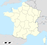
Region Île-de-France Département Seine-et-Marne Arrondissement Meaux Kanton Crécy-la-Chapelle Gemeindeverband Communauté de communes du Pays Créçois Koordinaten 48° 52′ N, 2° 54′ O48.8588888888892.907555Koordinaten: 48° 52′ N, 2° 54′ O Höhe 55 m (45–157 m) Fläche 15,78 km² Einwohner 4.083 (1. Jan. 2008) Bevölkerungsdichte 259 Einw./km² Postleitzahl 77580 INSEE-Code 77142 Website http://www.crecylachapelle.eu/ 
Kirche Notre-Dame in Crécy-la-ChapelleCrécy-la-Chapelle ist eine französische Gemeinde mit 4083 Einwohnern (Stand 1. Januar 2008) im Département Seine-et-Marne in der Region Île-de-France; sie gehört zum Arrondissement Meaux und zum Kanton Crécy-la-Chapelle.
Inhaltsverzeichnis
Geografie
Die Stadt liegt am Ufer des Flusses Grand Morin.
Ortsteile: Crécy Bourg, Montbarbin, Serbonne, La Chapelle, Libernon, Mongrolle, Ferolles, Montaudier
Nachbargemeinden: Bouleurs, Villiers-sur-Morin, Couilly-Pont-aux-Dames, Voulangis, Guérard, Maisoncelles-en-BrieGeschichte
Die Gemeinde Crécy-la-Chapelle wurde am 1. Oktober 1972 aus den Gemeinden Crécy-en-Brie und La-Chapelle-sur-Crécy gebildet. Der Name Crécy tritt erstmals im 7. Jahrhundert als Criscecus, Crideciacavico oder Creciacum auf. Im 9. Jahrhundert wurde die erste Festung gebaut (siehe Grafschaft Crécy).
Bevölkerungsentwicklung
Bevölkerungsentwicklung in Crécy-la-Chapelle Jahr Einwohner 
1962 1849 1968 1928 1975 2193 1982 2413 1990 3222 1999 3851 Sehenswürdigkeiten
- Stiftskirche von La Chapelle
Städtepartnerschaften
- Pielenhofen in Deutschland
Weblinks
 Commons: Crécy-la-Chapelle – Sammlung von Bildern, Videos und AudiodateienKategorien:
- Gemeinde im Département Seine-et-Marne
- Ort in der Île-de-France
Wikimedia Foundation.

