- Lawrence County (Arkansas)
-
Verwaltung US-Bundesstaat: Arkansas Verwaltungssitz: Walnut Ridge Adresse des
Verwaltungssitzes:County Courthouse
P.O. Box 553
Walnut Ridge, AR 72476-0553Gründung: 15. Januar 1815 Gebildet aus: Madrid County, Missouri Vorwahl: 001 870 Demographie Einwohner: 17.415 (2010) Bevölkerungsdichte: 11,5 Einwohner/km² Geographie Fläche gesamt: 1.534 km² Wasserfläche: 15 km² Karte 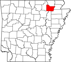
Das Lawrence County[1] ist ein County im US-amerikanischen Bundesstaat Arkansas. Bei der Volkszählung im Jahr 2010 hatte das County 17.415 Einwohner und eine Bevölkerungsdichte von 11,5 Einwohnern pro Quadratkilometer. Der Verwaltungssitz (County Seat) ist Walnut Ridge.[2] Das County gehört zu den Dry Countys, was bedeutet, dass der Verkauf von Alkohol eingeschränkt oder verboten ist.
Inhaltsverzeichnis
Geografie
Das County liegt im Nordosten von Arkansas, ist im Norden etwa 40 km von Missouri entfernt und hat eine Fläche von 1.534 Quadratkilometern, wovon 15 Quadratkilometer Wasserfläche sind. Es grenzt an folgende Countys:
Randolph County Sharp County 
Greene County Independence County Jackson County Craighead County Geschichte
 Lawrence
Das Lawrence County wurde am 15. Januar 1815 aus dem heute nicht mehr existierenden Madrid County in Missouri gebildet. Benannt wurde es nach Captain James Lawrence (1781–1813), der mit dem Spruch: „Don't give up the ship“ im Britisch-Amerikanischen Krieg von 1812, nachdem er bereits tödlich verwundet worden war, bekannt wurde.
Die frühste wichtige Ansiedlung war das an den Ufern des Black River gelegene Davidsonville, das nach dem Abgeordneten John Davidson benannt worden war. Die Stadt diente 1816 als erster Verwaltungssitz des Countys. Die Stadt wuchs auf über 3.000 Einwohner, bevor das Gelbfieber die weitere Ansiedlung beendete. 1829 hörte die Stadt auf zu existieren.
Eine andere wichtige Ansiedlung war Smithville, nahe der westlichen Countygrenze. Benannt wurde die Stadt nach dem Geschäftsmann Robert Smith. Ab 1837 diente sie als County Seat. Nach Fertigstellung der Iron Mountain Railroad wurde 1870 Walnut Ridge zum County Seat.
Demografische Daten
Historische Einwohnerzahlen Census Einwohner ± in % 1820 5592 — 1830 2806 -50 % 1840 2835 1 % 1850 5274 90 % 1860 9372 80 % 1870 5981 -40 % 1880 8782 50 % 1890 12.984 50 % 1900 16.491 30 % 1910 20.001 20 % 1920 22.098 10 % 1930 21.663 -2 % 1940 22.651 5 % 1950 21.303 -6 % 1960 17.267 -20 % 1970 16.320 -5 % 1980 18.447 10 % 1990 17.457 -5 % 2000 17.774 2 % 2010 17.415 -2 % 1820–1890[3] 1900–1990[4] 2010[5] Nach der Volkszählung im Jahr 2010 lebten im Lawrence County 17.415 Menschen in 7.069 Haushalten. Die Bevölkerungsdichte betrug 11,5 Einwohner pro Quadratkilometer.
Ethnisch betrachtet setzte sich die Bevölkerung zusammen aus 97,3 Prozent Weißen, 0,8 Prozent Afroamerikanern, 0,4 Prozent amerikanischen Ureinwohnern, 0,1 Prozent Asiaten sowie aus anderen ethnischen Gruppen; 1,2 Prozent stammten von zwei oder mehr Ethnien ab. Unabhängig von der ethnischen Zugehörigkeit waren 0,9 Prozent der Bevölkerung spanischer oder lateinamerikanischer Abstammung.
In den 7.069 Haushalten lebten statistisch je 2,26 Personen.
22,7 Prozent der Bevölkerung waren unter 18 Jahre alt, 58,6 Prozent waren zwischen 18 und 64 und 18,7 Prozent waren 65 Jahre oder älter. 51,5 Prozent der Bevölkerung war weiblich.
Das jährliche Durchschnittseinkommen eines Haushalts lag bei 31.045 USD. Das Pro - Kopf - Einkommen betrug 15.520 USD. 23,5 Prozent der Einwohner lebten unterhalb der Armutsgrenze.[6]
Städte und Gemeinden
- Alicia
- Black Rock
- Hoxie
- Walnut Ridge
- College City
- Imboden
- Lynn
- Minturn
- Portia
- Powhatan
- Ravenden
- Sedgewick
- Smithville
- Strawberry
- Calamine
- Clover Bend
- Hopewell
- Saffell
Einzelnachweise
- ↑ GNIS-ID: 66865. Abgerufen am 22. Februar 2011 (englisch).
- ↑ National Association of Counties Abgerufen am 3. Oktober 2011
- ↑ U.S. Census Bureau _ Census of Population and Housing Abgerufen am 17. Februar 2011
- ↑ Auszug aus Census.gov Abgerufen am 15. Februar 2011
- ↑ United States Census 2010 Abgerufen am 3. Oktober 2011
- ↑ U.S. Census Buero, State & County QuickFacts - Lawrence County Abgerufen am 3. Oktober 2011
Weblinks
-
 Commons: Lawrence County, Arkansas – Sammlung von Bildern, Videos und Audiodateien
 - U.S. Census Buero, State & County QuickFacts - Lawrence County
- Yahoo Bildersuche - Lawrence County
- www.city-data.com - Lawrence County
- Association of Arkansas Counties

Liste der Countys in Arkansas
Arkansas | Ashley | Baxter | Benton | Boone | Bradley | Calhoun | Carroll | Chicot | Clark | Clay | Cleburne | Cleveland | Columbia | Conway | Craighead | Crawford | Crittenden | Cross | Dallas | Desha | Drew | Faulkner | Franklin | Fulton | Garland | Grant | Greene | Hempstead | Hot Spring | Howard | Independence | Izard | Jackson | Jefferson | Johnson | Lafayette | Lawrence | Lee | Lincoln | Little River | Logan | Lonoke | Madison | Marion | Miller | Mississippi | Monroe | Montgomery | Nevada | Newton | Ouachita | Perry | Phillips | Pike | Poinsett | Polk | Pope | Prairie | Pulaski | Randolph | Saline | Scott | Searcy | Sebastian | Sevier | Sharp | St. Francis | Stone | Union | Van Buren | Washington | White | Woodruff | Yell
Wikimedia Foundation.
Schlagen Sie auch in anderen Wörterbüchern nach:
Lawrence County, Arkansas — Infobox U.S. County county = Lawrence County state = Arkansas map size = 225 founded = January 15, 1815 seat = Walnut Ridge | area total sq mi =592 area land sq mi =587 area water sq mi =6 area percentage = 0.98% census yr = 2000 pop = 17774… … Wikipedia
National Register of Historic Places listings in Lawrence County, Arkansas — Location of Lawrence County in Arkansas This is a list of the National Register of Historic Places listings in Lawrence County, Arkansas. This is intended to be a complete list of the properties and districts on the National Register of Historic… … Wikipedia
Lawrence County — is the name of eleven counties in the United States. All but the one in South Dakota were named for the U.S. naval hero of the War of 1812, Captain James Lawrence. Lawrence County, Alabama Lawrence County, Arkansas Lawrence County, Illinois… … Wikipedia
Lawrence County — Es gibt in den Vereinigten Staaten elf Countys mit dem Namen Lawrence County: Lawrence County (Alabama) Lawrence County (Arkansas) Lawrence County (Illinois) Lawrence County (Indiana) Lawrence County (Kentucky) Lawrence County (Mississippi)… … Deutsch Wikipedia
Lawrence County (Missouri) — Verwaltung US Bundesstaat: Missouri Verwaltungssitz: Mount Vernon Adresse des Verwaltungssitzes: County Courthouse 1 East Courthouse Square Mount Vernon, MO 65712 1444 Gründung: 1845 … Deutsch Wikipedia
Lawrence County — Comté de Lawrence Cette page d’homonymie répertorie les différents comtés partageant un même nom. Onze comtés des États Unis portent le nom de comté de Lawrence (Lawrence County) : le comté de Lawrence, situé dans l État de l… … Wikipédia en Français
Craighead County, Arkansas — Location in the state of Arkansas … Wikipedia
Randolph County, Arkansas — Infobox U.S. County county = Randolph County state = Arkansas map size = 225 founded = October 29, 1835 seat = Pocahontas area total sq mi =656 area land sq mi =652 area water sq mi =4 area percentage = 0.64% census yr = 2000 pop = 18195 density… … Wikipedia
Jackson County, Arkansas — Location in the state of Arkansas … Wikipedia
Randolph County (Arkansas) — Das Randolph County Courthouse in Pocahontas, seit 1996 im NRHP gelistet[1] … Deutsch Wikipedia
Lawrence County (Arkansas)


18+
© Academic, 2000-2024
- Kontaktieren Sie uns: Unterstützung, Werbung
Wörterbücher Export, schritte mit PHP, Joomla, Drupal, WordPress, MODx.