- Złotniki Kujawskie
-
Złotniki Kujawskie 

Złotniki Kujawskie Basisdaten Staat: Polen Woiwodschaft: Kujawien-Pommern Landkreis: Inowrocław Geographische Lage: 52° 54′ N, 18° 8′ O52.918.133333333333Koordinaten: 52° 54′ 0″ N, 18° 8′ 0″ O Einwohner: -
(31. Dez. 2010)[1]Postleitzahl: 88-180 Telefonvorwahl: (+48) 52 Kfz-Kennzeichen: CIN Wirtschaft und Verkehr Schienenweg: Poznań–Bydgoszcz Gemeinde Gemeindeart: Landgemeinde Gemeindegliederung: 20 Schulzenämter Fläche: 135,6 km² Einwohner: 9094
(31. Dez. 2010) [2]Bevölkerungsdichte: 67 Einw./km² Gemeindenummer (GUS): 0407092 Verwaltung Gemeindevorsteher: Henryk Józef Styrna Adresse: ul.Powstańców Wielkopolskich 3
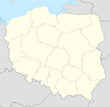
88-180 Złotniki KujawskieWebpräsenz: www.zlotnikikuj.cc.pl Złotniki Kujawskie (deutsch Güldenhof) ist ein Dorf und Sitz der gleichnamigen Landgemeinde in Polen. Der Ort liegt im Powiat Inowrocławski der Wojewodschaft Kujawien-Pommern.
Inhaltsverzeichnis
Gemeinde
Zur Landgemeinde Zlotniki Kujawskie gehören 20 Ortsteile (deutsche Namen bis 1945)[3][4][5] mit einem Schulzenamt:
- Będzitowo
- Broniewo (Broniewo, 1940–1945: Brunsdorf)[5]
- Dąbrówka Kujawska (Dombrowken, 1940–1945: Parkwiese)[3]
- Dobrogościce (Dobrogoschütz, 1940–1945: Hempelhof)[3]
- Dźwierzchno (Kaisertreu)[4]
- Gniewkówiec (Gniewkowitz, 1940–1945: Argendorf)[3]
- Jordanowo (Jordanowo)[4]
- Krężoły (Krenzoly)[4]
- Leszcze
- Lisewo Kościelne (Liebensee)[3]
- Mierzwin (Mierzwin)[4]
- Niszczewice
- Palczyn (Palczyn, 1940–1945: Paulhof)[3]
- Pęchowo (Penchowo, 1940–1945: Hohenwart)[3]
- Rucewko (1940–1945: Klein Eichenbarleben)[3]
- Rucewo (1940–1945: Eichenbarleben)[3]
- Tarkowo Górne (Tannhofen)[3]
- Tuczno (osada)
- Tuczno (wieś) (Tuczno)[3]
- Złotniki Kujawskie (Güldenhof)[3]
Weitere Ortschaften der Gemeinde sind:
Verweise
Weblinks
- Deutsche Heereskarte, 3074 Penchowo (Topograph. Karte, 1:25000), Ausgabe 1 vom XI. 1944
- Deutsche Heereskarte, 3174 Pakosch (Topograph. Karte, 1:25000), Ausgabe 1 vom XI. 1944
- Deutsche Heereskarte, 3075 Gr. Wodeck (Topograph. Karte, 1:25000), Ausgabe 1 vom XI. 1944
Fußnoten
- ↑ Population. Size and Structure by Territorial Division. As of December 31, 2010. Główny Urząd Statystyczny (GUS), abgerufen am 9. Juli 2011.
- ↑ Population. Size and Structure by Territorial Division. As of December 31, 2010. Główny Urząd Statystyczny (GUS), abgerufen am 9. Juli 2011.
- ↑ a b c d e f g h i j k l m n Vgl. Deutsche Heereskarte, 3074 Penchowo
- ↑ a b c d e f Vgl. Deutsche Heereskarte, 3174 Pakosch
- ↑ a b c d e Vgl. Deutsche Heereskarte, 3075 Wodeck
Kategorien:- Gmina in der Woiwodschaft Kujawien-Pommern
- Ort der Woiwodschaft Kujawien-Pommern


Wikimedia Foundation.