- Jones County (South Dakota)
-
Verwaltung US-Bundesstaat: South Dakota Verwaltungssitz: Murdo Gründung: 1916 Demographie Einwohner: 1193 (2000) Bevölkerungsdichte: 0,5 Einwohner/km² Geographie Fläche gesamt: 2.517 km² Wasserfläche: 3 km² Karte 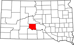
Jones County[1] ist ein County im Bundesstaat South Dakota der Vereinigten Staaten von Amerika.
Inhaltsverzeichnis
Geographie
Das County hat eine Fläche von 2517 Quadratkilometern; davon sind 3 Quadratkilometer (0,12 Prozent) Wasserflächen. Er ist in 13 Townships eingeteilt: Buffalo, Draper, Dunkel, Grandview, Kolls, Morgan, Mullen, Mussman, Okaton, Scovil, South Creek, Williams Creek und Zickrick; sowie vier unorganisierte Territorien: Central Jones, North Jones, Rich Valley und Westover.
Bevölkerungsentwicklung
Historische Einwohnerzahlen Census Einwohner ± in % 1920 3004 — 1930 3177 6 % 1940 2509 -20 % 1950 2281 -9 % 1960 2066 -9 % 1970 1882 -9 % 1980 1463 -20 % 1990 1324 -10 % 2000 1193 -10 % 2010 1006 -20 % 1900–1990[2] 2000[3]
Städte und Gemeinden
Städte (cities)
- Murdo
Gemeinden (towns)
- Draper
- Okaton
Einzelnachweise
- ↑ Jones County im Geographic Names Information System des United States Geological Survey. Abgerufen am 22. Februar 2011
- ↑ Auszug aus Census.gov. Abgerufen am 28. Februar 2011
- ↑ Auszug aus factfinder.census.gov Abgerufen am 28. Februar 2011

Liste der Countys in South Dakota
Aurora | Beadle | Bennett | Bon Homme | Brookings | Brown | Brule | Buffalo | Butte | Campbell | Charles Mix | Clark | Clay | Codington | Corson | Custer | Davison | Day | Deuel | Dewey | Douglas | Edmunds | Fall River | Faulk | Grant | Gregory | Haakon | Hamlin | Hand | Hanson | Harding | Hughes | Hutchinson | Hyde | Jackson | Jerauld | Jones | Kingsbury | Lake | Lawrence | Lincoln | Lyman | Marshall | McCook | McPherson | Meade | Mellette | Miner | Minnehaha | Moody | Pennington | Perkins | Potter | Roberts | Sanborn | Shannon | Spink | Stanley | Sully | Todd | Tripp | Turner | Union | Walworth | Yankton | Ziebach
Wikimedia Foundation.
Schlagen Sie auch in anderen Wörterbüchern nach:
Jones County, South Dakota — Infobox U.S. County county = Jones County state = South Dakota founded year = 1916 founded date = seat wl = Murdo largest city wl = area total sq mi = 972 area total km2 = 2517 area land sq mi = 971 area land km2 = 2514 area water sq mi = 1 area… … Wikipedia
National Register of Historic Places listings in Jones County, South Dakota — Location of Jones County in South Dakota This is a list of the National Register of Historic Places listings in Jones County, South Dakota. This is intended to be a complete list of the properties on the National Register of Historic Places in… … Wikipedia
Zickrick Township, Jones County, South Dakota — Zickrick is a township in South Dakota. It is 1,867 feet above sea level. [cite web | last = | first = | authorlink = | coauthors = | title =Zickrick, South Dakota | work = | publisher =ePodunk | date = | url =http://www.epodunk.com/cgi… … Wikipedia
Jackson County, South Dakota — Location in the state of South Dakota … Wikipedia
Mellette County, South Dakota — Location in the state of South Dakota … Wikipedia
Minnehaha County (South Dakota) — Verwaltung US Bundesstaat: South Dakota Verwaltungssitz: Sioux Falls Adresse des Verwaltungssitzes: Gründung … Deutsch Wikipedia
Ziebach County (South Dakota) — Verwaltung US Bundesstaat: South Dakota Verwaltungssitz: Dupree Adresse des Verwaltungssitzes: Gründung … Deutsch Wikipedia
Haakon County, South Dakota — Infobox U.S. County county = Haakon County state = South Dakota founded year = founded date = seat wl = Philip largest city wl = area total sq mi = 1827 area total km2 = 4732 area land sq mi =1813 area land km2 = 4696 area water sq mi = 14 area… … Wikipedia
Lyman County, South Dakota — Infobox U.S. County county = Lyman County state = South Dakota founded year = founded date = seat wl = Kennebec largest city wl = area total sq mi = 1707 area total km2 = 4421 area land sq mi =1640 area land km2 = 4247 area water sq mi = 67 area… … Wikipedia
Stanley County, South Dakota — Infobox U.S. County county = Stanley County state = South Dakota founded year = founded date = seat wl = Fort Pierre largest city wl = area total sq mi = 1517 area total km2 = 3929 area land sq mi = 1443 area land km2 = 3738 area water sq mi = 74 … Wikipedia
Jones County (South Dakota)

18+
© Academic, 2000-2024
- Kontaktieren Sie uns: Unterstützung, Werbung
Wörterbücher Export, schritte mit PHP, Joomla, Drupal, WordPress, MODx.